
Scientific Research-Driven Climate & Environmental Solutions
Advanced research methods for climate change, remote sensing, water modeling, and precision agriculture.
Species Distribution Modeling
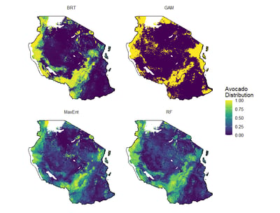
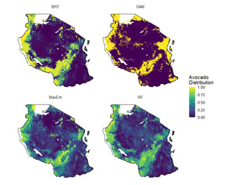
We use advanced methods to model species distributions with full quality control from start to finish. We provide clear maps and easy-to-understand results, helping you make informed decisions in distribution, conservation and environmental planning.
GIS Applications
Empower your business with our research-leading GIS solution. We provide specialized GIS training to equip your team with the skills needed to design custom maps that address your unique challenges.
Our training curriculum covers a broad spectrum of tools, including R, ArcGIS, Python, QGIS, ArcGIS Pro, and Google Earth Engine.
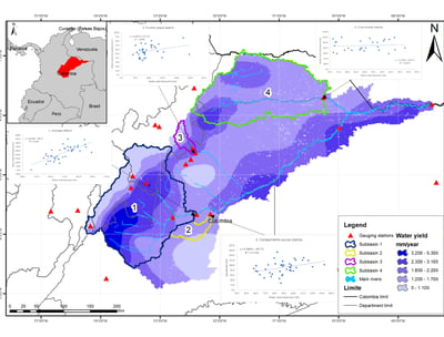
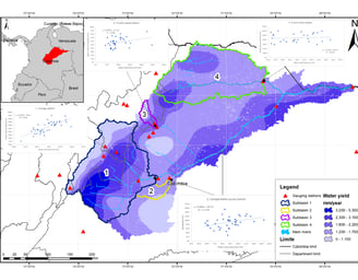
Our water modeling covers everything from basic models to advanced simulations. We provide accurate projections for water management and energy production using CMIP6 scenarios, so you can plan and manage water resources effectively.
Water Modeling
Climate Change Projections


We measure the impact of climate change on agriculture, water, and energy. Using both CMIP5 and CMIP6 scenarios, we integrate climate models to deliver clear insights into future trends, helping you plan for risk management and sustainable growth.
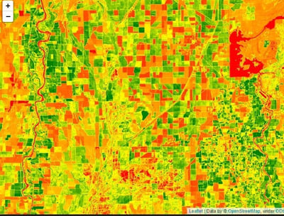
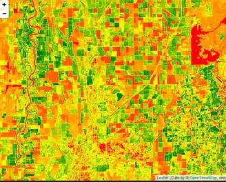
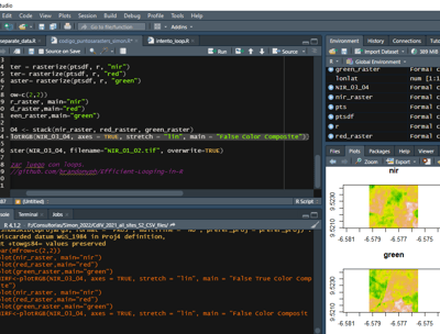
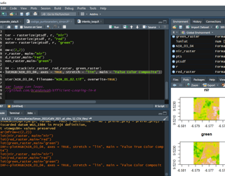
Remote Sensing
Our remote sensing service monitors crop evolution using plant indicators and performs land use classification. By using the latest satellite data (Landsat, S1, S2), we help you track environmental changes and support better decision-making in agriculture and conservation.
We build machine learning models to address a variety of challenges in hydrology, climate, and agriculture. Our solutions provide accurate predictions and automated insights, making your decision-making process more efficient and reliable.